 Old Cumbria Gazetteer
 |
 |
|
| Slaggyford Station, Slaggyford | ||
| Slaggyford Station | ||
| site name:- | Alston branch railway | |
| locality:- | Slaggyford | |
| civil parish:- | Knaresdale with Kirkhaugh | |
| county:- | Northumberland | |
| locality type:- | railway station | |
| coordinates:- | NY67615238 (?) | |
| 1Km square:- | NY6752 | |
| 10Km square:- | NY65 | |
| SummaryText:- | Opened 1852; closed 1976. | |
|
|
||
| evidence:- | old map:- OS County Series (Nhd 106A 4) placename:- Slaggyford Station item:- railway signal; railway bridge |
|
| source data:- | Maps, County Series maps of Great Britain, scales 6 and 25
inches to 1 mile, published by the Ordnance Survey, Southampton,
Hampshire, from about 1863 to 1948.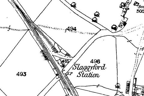 click to enlarge click to enlargeCSRY0191.jpg "Slaggyford Station / S.P." |
|
|
|
||
 Lakes Guides menu.