 Old Cumbria Gazetteer
 |
 |
|
| Crag, Troutbeck | ||
| Crag | ||
| locality:- | Troutbeck | |
| civil parish:- | Lakes (formerly Westmorland) | |
| county:- | Cumbria | |
| locality type:- | buildings | |
| locality type:- | locality | |
| coordinates:- | NY40800289 | |
| 1Km square:- | NY4002 | |
| 10Km square:- | NY40 | |
|
|
||
| evidence:- | possibly old map:- OS County Series (Wmd 26 11) placename:- Crag |
|
| source data:- | Maps, County Series maps of Great Britain, scales 6 and 25
inches to 1 mile, published by the Ordnance Survey, Southampton,
Hampshire, from about 1863 to 1948. |
|
|
|
||
| evidence:- | old text:- Martineau 1855 |
|
| source data:- | Guide book, A Complete Guide to the English Lakes, by Harriet
Martineau, published by John Garnett, Windermere, Westmorland,
and by Whittaker and Co, London, 1855; published 1855-76. goto source goto sourcePage 34:- "Troutbeck ... The valley now contains a string of hamlets,- Town End, Town Head, High Green, Crag, and High Fold; and its farmsteads and outbuildings show some of the most curious specimens of ancient edifices that are to be seen in the district. ..." |
|
|
|
||
| evidence:- | old photograph:- Bell 1880s-1940s |
|
| source data:- | Photograph, sepia, Crag, Troutbeck, Westmorland, by Herbert Bell, photographer, Ambleside,
Westmorland, 1890s.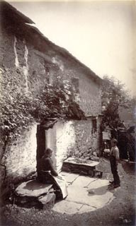 click to enlarge click to enlargeHB0749.jpg internegative at lower right:- "H. Bell" item:- Armitt Library : ALPS412 Image © see bottom of page |
|
|
|
||
Lakes Guides menu.