 Old Cumbria Gazetteer
 |
 |
|
| Dunfell Mine, Milburn | ||
| Dunfell Mine | ||
| locality:- | Great Dun Fell | |
| locality:- | Milburn Forest | |
| civil parish:- | Milburn (formerly Westmorland) | |
| county:- | Cumbria | |
| locality type:- | lead mine | |
| locality type:- | mine | |
| coordinates:- | NY72063187 | |
| 1Km square:- | NY7231 | |
| 10Km square:- | NY73 | |
|
|
||
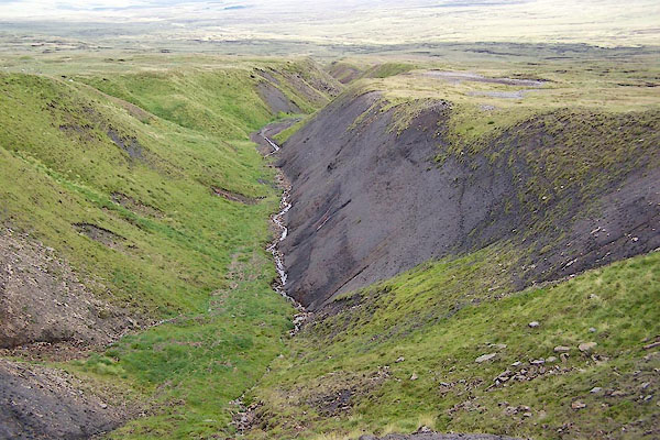 BRF43.jpg Dunfell Hush. (taken 3.8.2009) 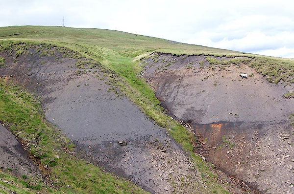 BRF44.jpg Dunfell Hush. (taken 3.8.2009) |
||
|
|
||
| evidence:- | old map:- OS County Series (Wmd 5 4) placename:- Dunfell Mine placename:- Dunfell Hush placename:- Henrake Hush |
|
| source data:- | Maps, County Series maps of Great Britain, scales 6 and 25
inches to 1 mile, published by the Ordnance Survey, Southampton,
Hampshire, from about 1863 to 1948. "Dunfell Mine (Old Lead Mine)" nearby are:- "Dunfell Hush" "Henrake Hush" |
|
|
|
||
 Lakes Guides menu.