 Old Cumbria Gazetteer
 |
 |
|
| Old Brewery, Ulverston | ||
| Old Brewery | ||
| Hartley's Brewery | ||
| Street:- | Brewery Street | |
| locality:- | Ulverston | |
| civil parish:- | Ulverston (formerly Lancashire) | |
| county:- | Cumbria | |
| locality type:- | brewery | |
| coordinates:- | SD28847840 (?) | |
| 1Km square:- | SD2878 | |
| 10Km square:- | SD27 | |
|
|
||
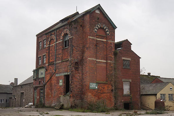 CCC35.jpg (taken 21.11.2014) 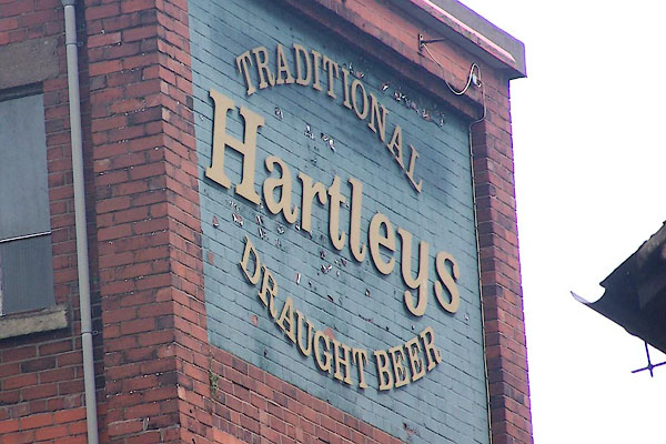 BNW49.jpg (taken 6.7.2007) |
||
|
|
||
| evidence:- | old map:- OS County Series (Lan 16 3) placename:- Old Brewery |
|
| source data:- | Maps, County Series maps of Great Britain, scales 6 and 25
inches to 1 mile, published by the Ordnance Survey, Southampton,
Hampshire, from about 1863 to 1948. |
|
|
|
||
| person:- | brewer : Hartleys |
|
| date:- | 2010 |
|
| item:- | ale |
|
|
|
||
 Lakes Guides menu.