 Old Cumbria Gazetteer
 |
 |
|
| Coledale Hall, Carlisle | ||
| Coledale Hall | ||
| Street:- | Newtown Road | |
| locality:- | Newtown | |
| civil parish:- | Carlisle (formerly Cumberland) | |
| county:- | Cumbria | |
| locality type:- | buildings | |
| coordinates:- | NY38365600 | |
| 1Km square:- | NY3856 | |
| 10Km square:- | NY35 | |
|
|
||
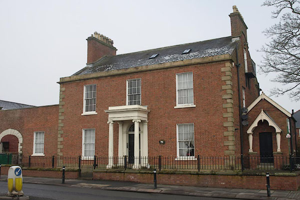 BSF27.jpg (taken 2.3.2010) |
||
|
|
||
| evidence:- | old map:- OS County Series (Cmd 23 3) placename:- Coledale Hall |
|
| source data:- | Maps, County Series maps of Great Britain, scales 6 and 25
inches to 1 mile, published by the Ordnance Survey, Southampton,
Hampshire, from about 1863 to 1948. |
|
|
|
||
| evidence:- | database:- Listed Buildings 2010 placename:- Coledale Hall |
|
| source data:- | courtesy of English Heritage "COLEDALE HALL / 94 AND 96 / NEWTOWN ROAD / CARLISLE / CARLISLE / CUMBRIA / II[star] / 386813 / NY3836755999" |
|
|
|
||
 Lakes Guides menu.