 Old Cumbria Gazetteer
 |
 |
|
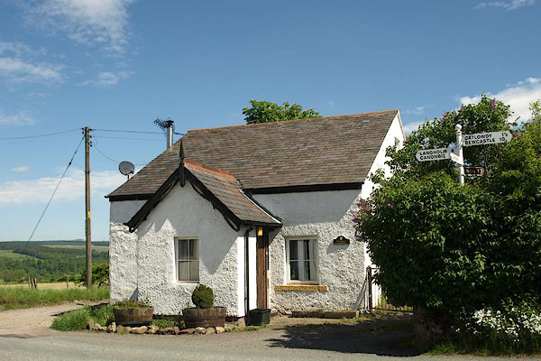
| Haithwaite Cottage, Nicholforest | ||
| Haithwaite Cottage | ||
| Haithwaite Turnpike | ||
| site name:- | road, Longtown to Newcastleton | |
| locality:- | Haithwaite | |
| civil parish:- | Nicholforest (formerly Cumberland) | |
| county:- | Cumbria | |
| locality type:- | toll gate (site) | |
| locality type:- | toll house (?ex) | |
| locality type:- | buildings | |
| coordinates:- | NY43847652 | |
| 1Km square:- | NY4376 | |
| 10Km square:- | NY47 | |
| references:- | OS County Series |
|
|
|
||
 BSV83.jpg (taken 4.6.2010) |
||
|
|
||
| evidence:- | old map:- OS County Series (Cmd 7 1) placename:- Haithwaite TP |
|
| source data:- | Maps, County Series maps of Great Britain, scales 6 and 25
inches to 1 mile, published by the Ordnance Survey, Southampton,
Hampshire, from about 1863 to 1948. "Haithwaite T.P" at a cross roads; one gate diagonally to block two ways, a second gate for the eastward road, and a building |
|
|
|
||
 Lakes Guides menu.