 Old Cumbria Gazetteer
 |
 |
|
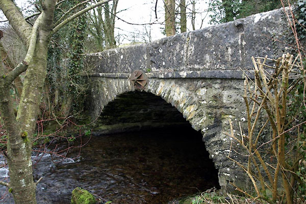
| Lords Bridge, Crosthwaite | ||
| Lords Bridge | ||
| site name:- | Gilpin, River | |
| locality:- | Crosthwaite | |
| civil parish:- | Crosthwaite and Lyth (formerly Westmorland) | |
| county:- | Cumbria | |
| locality type:- | bridge | |
| coordinates:- | SD43589137 | |
| 1Km square:- | SD4391 | |
| 10Km square:- | SD49 | |
|
|
||
 BWC01.jpg (taken 16.3.2012) 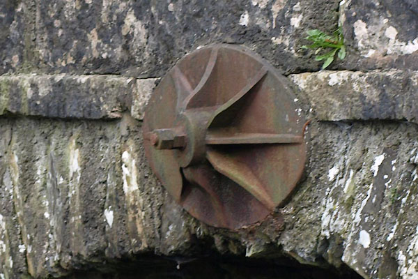 BWC02.jpg (taken 16.3.2012) |
||
|
|
||
| evidence:- | old map:- OS County Series (Wmd 38) placename:- Lords Bridge |
|
| source data:- | Maps, County Series maps of Great Britain, scales 6 and 25
inches to 1 mile, published by the Ordnance Survey, Southampton,
Hampshire, from about 1863 to 1948. "Lords Bridge" |
|
|
|
||
| evidence:- | database:- Listed Buildings 2010 placename:- Lords Bridge |
|
| source data:- | courtesy of English Heritage "LORDS BRIDGE / / / CROSTHWAITE AND LYTH / SOUTH LAKELAND / CUMBRIA / II / 77122 / SD4357691373" |
|
| source data:- | courtesy of English Heritage "Bridge over river Gilpin. Early C19. Stone rubble with dressed stone. Segmental arch with band over; parapets of large slabs. Later iron tie. On route of Kendal to Kirkby Ireleth turnpike road." |
|
|
|
||
 Lakes Guides menu.