 Old Cumbria Gazetteer
 |
 |
|
| Low Borrow Bridge Inn, Tebay | ||
| Low Borrow Bridge Inn | ||
| locality:- | Low Borrowbridge | |
| civil parish:- | Tebay (formerly Westmorland) | |
| county:- | Cumbria | |
| locality type:- | inn (gone) | |
| coordinates:- | NY61040120 (about) | |
| 1Km square:- | NY6101 | |
| 10Km square:- | NY60 | |
| references:- | OS County Series |
|
|
|
||
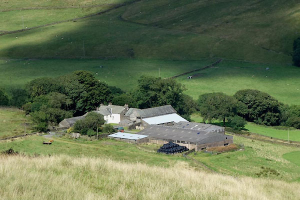 CGJ87.jpg (taken 10.8.2017) |
||
|
|
||
| evidence:- | old map:- OS County Series (Wmd 28) placename:- Low Borrow Bridge Inn |
|
| source data:- | Maps, County Series maps of Great Britain, scales 6 and 25
inches to 1 mile, published by the Ordnance Survey, Southampton,
Hampshire, from about 1863 to 1948. "Low Borrow Br. Inn" |
|
|
|
||
| evidence:- | old map:- Greenwood 1824 (Wmd) placename:- Barrow Bridge Inn |
|
| source data:- | Maps, Map of the County of Westmorland, scale about 1 inch to 1
mile, and Map of the County of Cumberland, scale about 1 inch to
1 mile, etc, by C and J Greenwood, published by George Pringle
jnr, 70 Queen Street, Cheapside, London, 1823 and 1824
respectively. "Barrow Bridge Inn" |
|
|
|
||
 Lakes Guides menu.