 Old Cumbria Gazetteer
 |
 |
|
| milestone, Crosthwaite and Lyth (2) | ||
| site name:- | road, Milnthorpe to Newby Bridge | |
| civil parish:- | Crosthwaite and Lyth (formerly Westmorland) | |
| county:- | Cumbria | |
| locality type:- | milestone | |
| coordinates:- | SD46038473 | |
| 1Km square:- | SD4684 | |
| 10Km square:- | SD48 | |
| references:- | OS County Series |
|
|
|
||
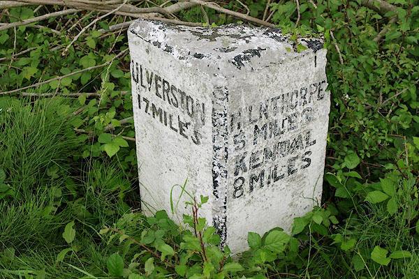 BSX58.jpg Inscribed stone:- "ULVERSTON 17 MILES / MILNTHORPE 5 MILES KENDAL 8 MILES" (taken 1.7.2010) |
||
|
|
||
| evidence:- | old map:- OS County Series (Wmd 42) |
|
| source data:- | Maps, County Series maps of Great Britain, scales 6 and 25
inches to 1 mile, published by the Ordnance Survey, Southampton,
Hampshire, from about 1863 to 1948. "M.S. ULVERSTON 17 MILNTHORPE 5" |
|
|
|
||
 Lakes Guides menu.