 Old Cumbria Gazetteer
 |
 |
|
| milestone, Haverthwaite | ||
| site name:- | road, Newby Bridge to Ulverston | |
| civil parish:- | Haverthwaite (formerly Lancashire) | |
| civil parish:- | Colton (formerly Lancashire) (?) | |
| county:- | Cumbria | |
| locality type:- | milestone | |
| coordinates:- | SD35018613 | |
| 1Km square:- | SD3586 | |
| 10Km square:- | SD38 | |
|
|
||
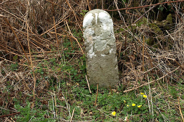 BSM12.jpg "[K] / 13" (taken 9.4.2010) |
||
|
|
||
| evidence:- | old map:- OS County Series (Lan 8) |
|
| source data:- | Maps, County Series maps of Great Britain, scales 6 and 25
inches to 1 mile, published by the Ordnance Survey, Southampton,
Hampshire, from about 1863 to 1948. "KENDAL 13 M.S." |
|
|
|
||
| evidence:- | database:- Listed Buildings 2010 |
|
| source data:- | courtesy of English Heritage "MILESTONE APPROXIMATELY 25 METRES WEST OF JUNCTION WITH LANE TO NORTH / / / HAVERTHWAITE / SOUTH LAKELAND / CUMBRIA / II / 421781 / SD3501586138" |
|
| source data:- | courtesy of English Heritage "Milestone. c.1763. For Kirkby Kendal to Kirkby Ireleth Turnpike Trust. Stone. Round-headed post inscribed with number 13 (miles from Kendal)." |
|
|
|
||
 Lakes Guides menu.