 Old Cumbria Gazetteer
 |
 |
|
| milestone, Bridgefoot | ||
| site name:- | road, Cockermouth to Whitehaven | |
| locality:- | Bridgefoot | |
| civil parish:- | Little Clifton (formerly Cumberland) | |
| county:- | Cumbria | |
| locality type:- | milestone | |
| coordinates:- | NY05212909 (guess) | |
| 1Km square:- | NY0529 | |
| 10Km square:- | NY02 | |
| references:- | OS County Series |
|
|
|
||
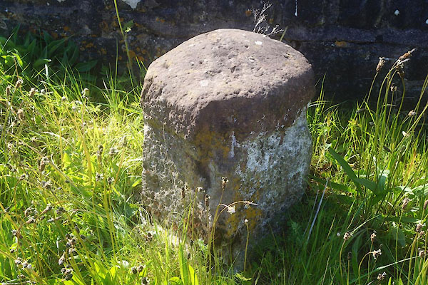 CGB71.jpg (taken 10.5.2017) |
||
| Cast iron plates missing? |
||
|
|
||
| evidence:- | old map:- OS County Series (Cmd 54 5) |
|
| source data:- | Maps, County Series maps of Great Britain, scales 6 and 25
inches to 1 mile, published by the Ordnance Survey, Southampton,
Hampshire, from about 1863 to 1948. "COCKERMOUTH .. 5 WHITEHAVEN 9 M.S." "" |
|
|
|
||
 Lakes Guides menu.