 Old Cumbria Gazetteer
 |
 |
|
| milestone, Warcop (2) | ||
| site name:- | road, Brough to Appleby | |
| civil parish:- | Warcop (formerly Westmorland) | |
| county:- | Cumbria | |
| locality type:- | milestone | |
| coordinates:- | NY71451852 | |
| 1Km square:- | NY7118 | |
| 10Km square:- | NY71 | |
| references:- | OS County Series |
|
|
|
||
| evidence:- | old map:- OS County Series (Wmd 15) |
|
| source data:- | Maps, County Series maps of Great Britain, scales 6 and 25
inches to 1 mile, published by the Ordnance Survey, Southampton,
Hampshire, from about 1863 to 1948. "M.S. BROUGH 6 APPLEBY 2" |
|
|
|
||
| evidence:- | old map:- Jefferys 1770 (Wmd) |
|
| source data:- | Map, 4 sheets, The County of Westmoreland, scale 1 inch to 1
mile, surveyed 1768, and engraved and published by Thomas
Jefferys, London, 1770.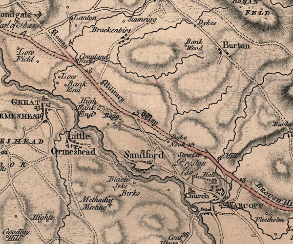 J5NY71NW.jpg "6" milestone marked by road item:- National Library of Scotland : EME.s.47 Image © National Library of Scotland |
|
|
|
||
| evidence:- | database:- Listed Buildings 2010 |
|
| source data:- | courtesy of English Heritage "MILESTONE TO SOUTH EAST OF SANDFORD THORN / / A66 / WARCOP / EDEN / CUMBRIA / II / 73385 / NY7145218506" |
|
| source data:- | courtesy of English Heritage "Milestone; C19. Single rough-dressed stone c3 ft high; square in plan, set diagonally. Inscribed in sans-serif lettering on dressed insets: BROUGH 6 MILES on north face, APPLEBY 2 MILES." |
|
|
|
||
 Lakes Guides menu.