 Old Cumbria Gazetteer
 |
 |
|
| Mill Bridge, Garsdale | ||
| Mill Bridge | ||
| site name:- | Clough River | |
| civil parish:- | Garsdale (formerly Yorkshire) | |
| county:- | Cumbria | |
| locality type:- | bridge | |
| coordinates:- | SD76729028 | |
| 1Km square:- | SD7690 | |
| 10Km square:- | SD79 | |
|
|
||
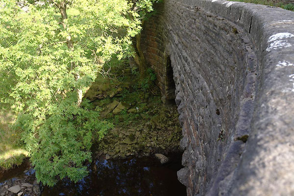 CBS86.jpg (taken 19.9.2014) |
||
|
|
||
| evidence:- | database:- Listed Buildings 2010 placename:- Mill Bridge |
|
| source data:- | courtesy of English Heritage "MILL BRIDGE TO NORTH EAST OF RAYGILL / / HAWES ROAD / GARSDALE / SOUTH LAKELAND / CUMBRIA / II / 484477 / SD7673190281" |
|
| source data:- | courtesy of English Heritage "Public road bridge over Clough River. Late C19. Graduated coursed rock-faced gritstone, coursed rubble parapets. Segmental arch with emphatically rock-faced voussoirs, strongly battered terminal piers, and flat copings to parapets which splay outwards at both ends." |
|
|
|
||
| evidence:- | old map:- OS County series (Yrk 64) placename:- Mill Bridge |
|
| source data:- | "Mill Bridge" |
|
|
|
||
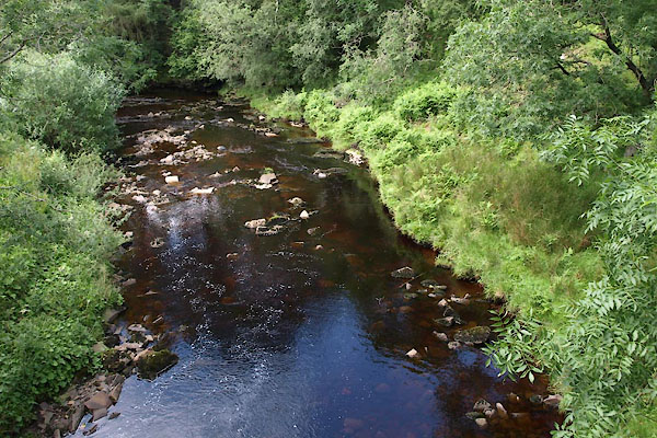 BWZ16.jpg View of river. (taken 27.7.2012) |
||
|
|
||
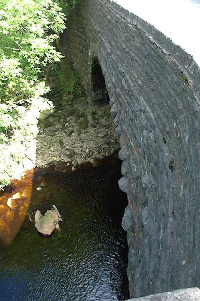 BWZ15.jpg (taken 27.7.2012) |
||
|
|
||
 Lakes Guides menu.