 Old Cumbria Gazetteer
 |
 |
|
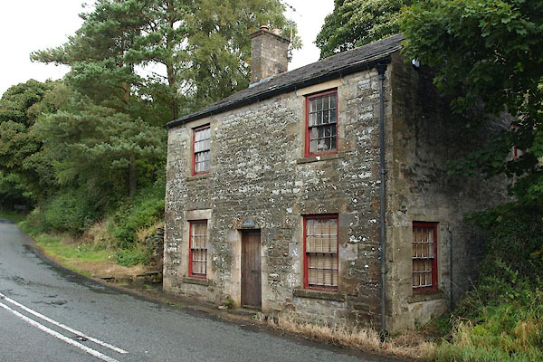
| Gate House, Alston Moor | ||
| Gate House | ||
| Newshieldbank Turnpike | ||
| site name:- | road, Alston to Hexham | |
| locality:- | Newshield Bank | |
| civil parish:- | Alston Moor (formerly Cumberland) | |
| county:- | Cumbria | |
| locality type:- | buildings | |
| locality type:- | toll house (ex) | |
| locality type:- | toll gate (site) | |
| coordinates:- | NY71644757 | |
| 1Km square:- | NY7147 | |
| 10Km square:- | NY74 | |
| references:- | OS County Series |
|
|
|
||
 BXL08.jpg (taken 28.9.2012) 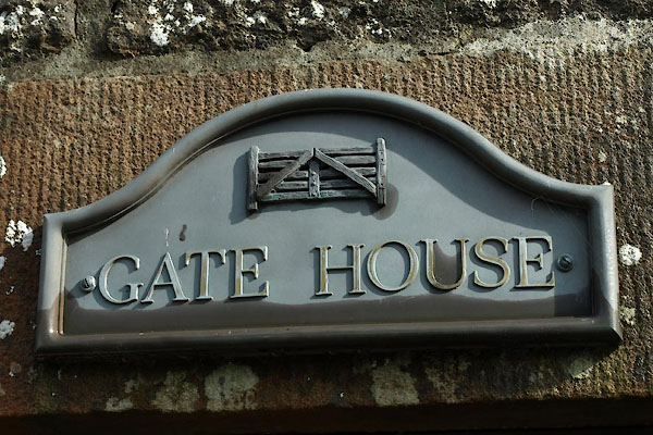 BXL09.jpg Sign. (taken 28.9.2012) |
||
|
|
||
| evidence:- | old map:- OS County Series (Cmd 34 5) placename:- Newshieldbank Turn Pike |
|
| source data:- | Maps, County Series maps of Great Britain, scales 6 and 25
inches to 1 mile, published by the Ordnance Survey, Southampton,
Hampshire, from about 1863 to 1948. "Newshieldbank T.P." at a fork; gate across the single road before the junction, and a building on the E side |
|
|
|
||
| evidence:- | database:- Listed Buildings 2010 placename:- Gatehouse, The |
|
| source data:- | courtesy of English Heritage "THE GATEHOUSE / / A686 / ALSTON MOOR / EDEN / CUMBRIA / II / 73086 / NY7163747572" |
|
|
|
||
 Lakes Guides menu.