 Old Cumbria Gazetteer
 |
 |
|
| Rigg Turnpike, Mallerstang | ||
| Rigg Turnpike | ||
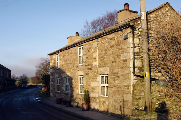
| Gate House | ||
| site name:- | road, Kirkby Stephen to Hawes | |
| locality:- | Mallerstang | |
| civil parish:- | Mallerstang (formerly Westmorland) | |
| county:- | Cumbria | |
| locality type:- | toll gate (site) | |
| coordinates:- | NY78290215 | |
| 1Km square:- | NY7802 | |
| 10Km square:- | NY70 | |
| references:- | OS County Series |
|
|
|
||
 BVU59.jpg (taken 13.1.2012) 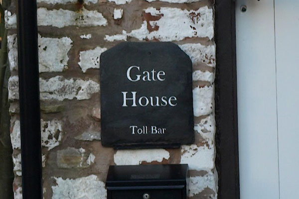 BVU60.jpg (taken 13.1.2012) |
||
|
|
||
| evidence:- | old map:- OS County Series (Wmd 30 15) |
|
| source data:- | Maps, County Series maps of Great Britain, scales 6 and 25
inches to 1 mile, published by the Ordnance Survey, Southampton,
Hampshire, from about 1863 to 1948. "Rigg T.P." gate across road and a building |
|
|
|
||
 Lakes Guides menu.