 Old Cumbria Gazetteer
 |
 |
|
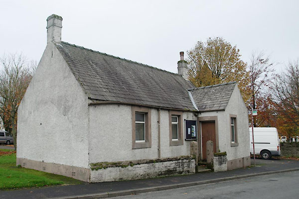
| school, Low Seaton | ||
| locality:- | Low Seaton | |
| locality:- | Seaton | |
| civil parish:- | Seaton (formerly Cumberland) | |
| county:- | Cumbria | |
| locality type:- | school (ex) | |
| coordinates:- | NY01863062 | |
| 1Km square:- | NY0130 | |
| 10Km square:- | NY03 | |
| references:- | OS County Series |
|
|
|
||
 BTT73.jpg (taken 5.11.2010) 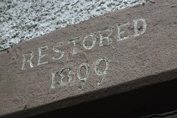 BTT74.jpg (taken 5.11.2010) |
||
|
|
||
| evidence:- | old map:- OS County Series (Cmd 53 4) |
|
| source data:- | Maps, County Series maps of Great Britain, scales 6 and 25
inches to 1 mile, published by the Ordnance Survey, Southampton,
Hampshire, from about 1863 to 1948. "Parochial School" |
|
|
|
||
 Lakes Guides menu.