 Old Cumbria Gazetteer
 |
 |
|
| Selside School, Whitwell and Selside | ||
| Selside Endowed CofE School | ||
| locality:- | Selside | |
| civil parish:- | Whitwell and Selside (formerly Westmorland) | |
| county:- | Cumbria | |
| locality type:- | school | |
| coordinates:- | SD54009883 | |
| 1Km square:- | SD5498 | |
| 10Km square:- | SD59 | |
| references:- | OS County Series |
|
|
|
||
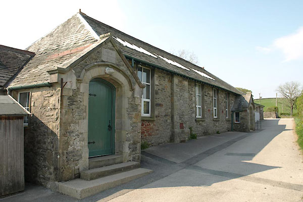 BUL56.jpg (taken 29.4.2011) 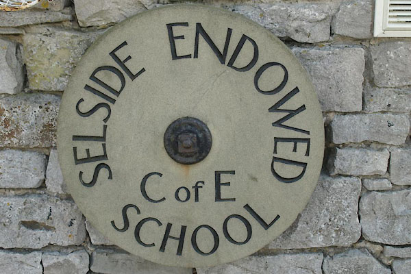 BUL59.jpg School sign:- "SELSIDE ENDOWED CofE SCHOOL" (taken 29.4.2011) |
||
|
|
||
| evidence:- | old map:- OS County Series (Wmd 34 5) placename:- Selside School |
|
| source data:- | Maps, County Series maps of Great Britain, scales 6 and 25
inches to 1 mile, published by the Ordnance Survey, Southampton,
Hampshire, from about 1863 to 1948. "Selside School (Endowed)" |
|
|
|
||
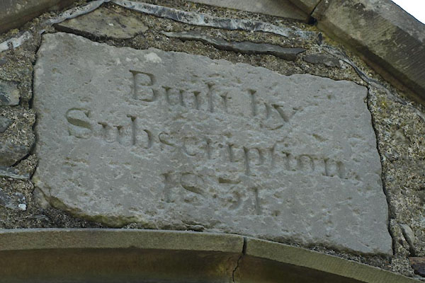 BUL57.jpg Plaque:- "Built by / Subscription / 1831." (taken 29.4.2011) 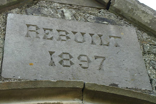 BUL58.jpg Plaque:- "REBUILT / 1897" (taken 29.4.2011) |
||
|
|
||
| notes:- |
Built by John Kitching, 1730. Rebuilt 1831. |
|
|
|
||
 Lakes Guides menu.