 Old Cumbria Gazetteer
 |
 |
|
| Stonybeck Turnpike, Penrith | ||
| Stonybeck Turnpike | ||
| site name:- | road, Penrith to Carlisle | |
| locality:- | Stonybeck | |
| civil parish:- | Penrith (formerly Cumberland) | |
| county:- | Cumbria | |
| locality type:- | toll gate (site) | |
| coordinates:- | NY50533387 | |
| 1Km square:- | NY5033 | |
| 10Km square:- | NY53 | |
| references:- | OS County Series |
|
|
|
||
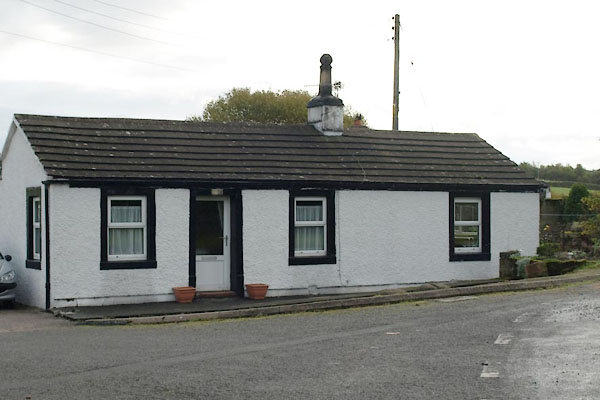 BTS09.jpg Probably the old toll house. (taken 22.10.2010) |
||
|
|
||
| evidence:- | old map:- OS County Series (Cmd 49 12) |
|
| source data:- | Maps, County Series maps of Great Britain, scales 6 and 25
inches to 1 mile, published by the Ordnance Survey, Southampton,
Hampshire, from about 1863 to 1948. "Stonybeck T.P." on old road to Penrith; 5 roads meet here; there is a gate and a building for the road to Penrith, a related Check TP on the road east, and possible gates on the other side roads |
|
|
|
||
 Lakes Guides menu.