 Old Cumbria Gazetteer
 |
 |
|
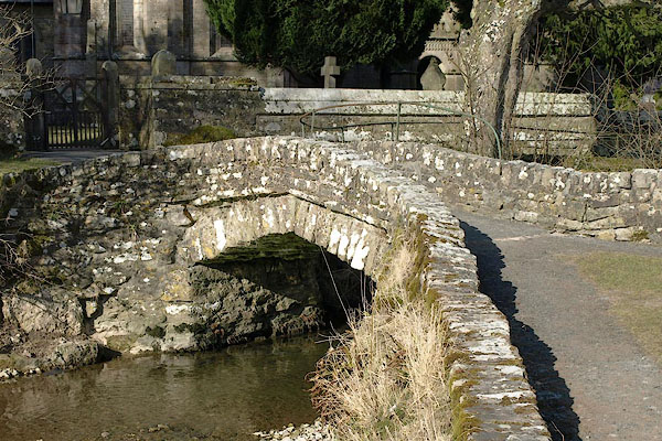
| Church Bridge, Crosby Ravensworth | ||
| Church Bridge | ||
| site name:- | Dalebanks Beck | |
| locality:- | Crosby Ravensworth | |
| civil parish:- | Crosby Ravensworth (formerly Westmorland) | |
| county:- | Cumbria | |
| locality type:- | footbridge | |
| locality type:- | bridge | |
| locality type:- | packhorse bridge (?) | |
| coordinates:- | NY62141480 | |
| 1Km square:- | NY6214 | |
| 10Km square:- | NY61 | |
|
|
||
 BSH51.jpg (taken 14.3.2010) 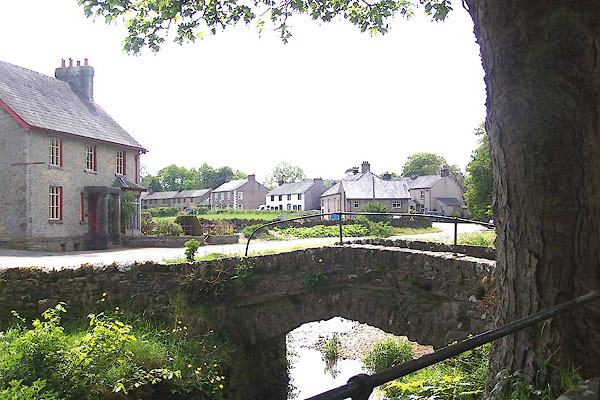 BME44.jpg (taken 30.5.2006) |
||
|
|
||
| evidence:- | old map:- OS County Series (Wmd 14 16) placename:- Church Bridge |
|
| source data:- | Maps, County Series maps of Great Britain, scales 6 and 25
inches to 1 mile, published by the Ordnance Survey, Southampton,
Hampshire, from about 1863 to 1948. |
|
|
|
||
| evidence:- | database:- Listed Buildings 2010 |
|
| source data:- | courtesy of English Heritage "FOOTBRIDGE OVER DALESBANK BECK TO SOUTH OF CHURCH / / / CROSBY RAVENSWORTH / EDEN / CUMBRIA / II / 74038 / NY6214614805" |
|
| source data:- | courtesy of English Heritage "Footbridge. Probably C19. Constructed of coursed rubble. Single segmental arch spanning c.6 ft. Pathway is c.4 ft wide; parapets are c.2 ft high, with splayed ends, constructed of dressed copings laid end down." |
|
|
|
||
| :- |
Perhaps not a packhorse bridge, but just for access to the church. |
|
| Hinchcliffe, Ernest: 1994: Packhorse Bridges of England: Cicerone Press (Milnthorpe,
Cumbria) |
||
|
|
||
 Lakes Guides menu.