 Old Cumbria Gazetteer
 |
 |
|
| milestone, St John's Castlerigg etc (8) | ||
| site name:- | road, Ambleside to Keswick | |
| civil parish:- | St John's Castlerigg and Wythburn (formerly Cumberland) | |
| county:- | Cumbria | |
| locality type:- | milestone | |
| coordinates:- | NY32341430 | |
| 1Km square:- | NY3214 | |
| 10Km square:- | NY31 | |
| references:- | OS County Series |
|
|
|
||
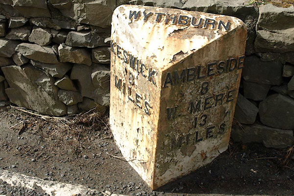 BSH86.jpg Cast iron:- "WYTHBURN / KESWICK 8 MILES / AMBLESIDE 8 W_MERE 13 MILES" (taken 19.3.2010) |
||
|
|
||
| evidence:- | old map:- OS County Series (Cmd 71) |
|
| source data:- | Maps, County Series maps of Great Britain, scales 6 and 25
inches to 1 mile, published by the Ordnance Survey, Southampton,
Hampshire, from about 1863 to 1948. "M.S. KESWICK 8 AMBLESIDE 8" |
|
|
|
||
 Lakes Guides menu.