 Old Cumbria Gazetteer
 |
 |
|
| school, Rough Hill | ||
| Rough Hill School | ||
| locality:- | Low Roughill | |
| locality:- | Rough Hill | |
| locality:- | Butterwick | |
| civil parish:- | Bampton (formerly Westmorland) | |
| county:- | Cumbria | |
| locality type:- | school (once) | |
| coordinates:- | NY49881923 | |
| 1Km square:- | NY4919 | |
| 10Km square:- | NY41 | |
| references:- | OS County Series |
|
|
|
||
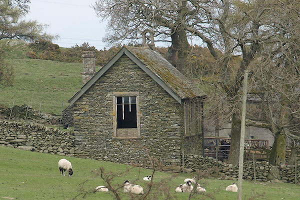 BSO46.jpg (taken 23.4.2010) |
||
|
|
||
| evidence:- | old map:- OS County Series (Wmd 13 3) |
|
| source data:- | Maps, County Series maps of Great Britain, scales 6 and 25
inches to 1 mile, published by the Ordnance Survey, Southampton,
Hampshire, from about 1863 to 1948. "Endowed School" |
|
|
|
||
 Lakes Guides menu.