 Old Cumbria Gazetteer
 |
 |
|
| pinfold, Hartley | ||
| locality:- | Hartley | |
| civil parish:- | Hartley (formerly Westmorland) | |
| county:- | Cumbria | |
| locality type:- | pinfold | |
| coordinates:- | NY78280892 | |
| 1Km square:- | NY7808 | |
| 10Km square:- | NY70 | |
|
|
||
 BSP54.jpg (taken 30.4.2010) 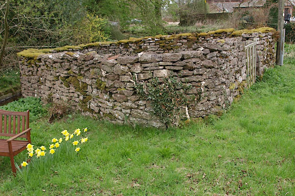 BSP55.jpg (taken 30.4.2010) |
||
|
|
||
| evidence:- | old map:- OS County Series (Wmd 23 11) |
|
| source data:- | Maps, County Series maps of Great Britain, scales 6 and 25
inches to 1 mile, published by the Ordnance Survey, Southampton,
Hampshire, from about 1863 to 1948. "Pinfold" |
|
|
|
||
| evidence:- | database:- Listed Buildings 2010 |
|
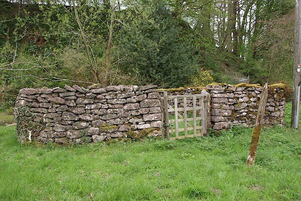
| source data:- | courtesy of English Heritage "PINFOLD TO SOUTH OF HARTLEY FOLD FARMHOUSE / / / HARTLEY / EDEN / CUMBRIA / II / 73334 / NY7827008934" |
|
| source data:- | courtesy of English Heritage "Pinfold, possibly late C18. Drystone walling c5 ft with rough-dressed gate posts. Trapezoid in plan with C20 wooden gate to centre of side facing street." |
|
|
|
||
 Lakes Guides menu.