 Old Cumbria Gazetteer
 |
 |
|
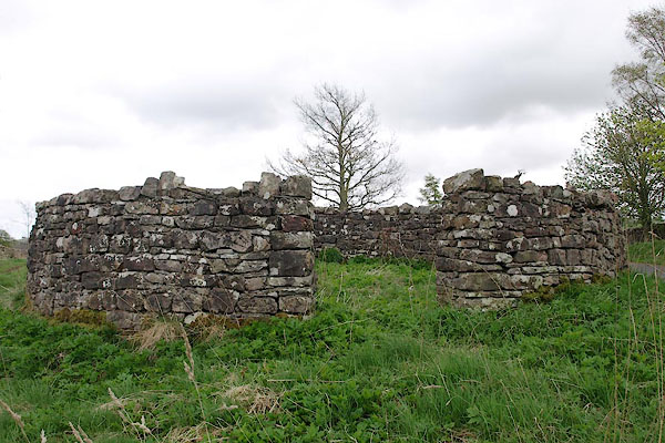
| pinfold, Winton | ||
| locality:- | Hunger Rigg | |
| locality:- | Winton | |
| civil parish:- | Winton (formerly Westmorland) | |
| county:- | Cumbria | |
| locality type:- | pinfold | |
| coordinates:- | NY78811057 | |
| 1Km square:- | NY7810 | |
| 10Km square:- | NY71 | |
|
|
||
 BSP76.jpg (taken 30.4.2010) 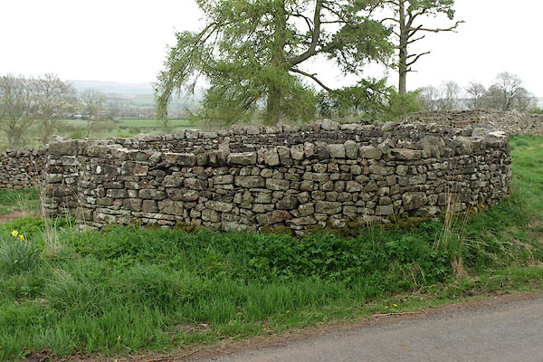 BSP75.jpg (taken 30.4.2010) |
||
|
|
||
| evidence:- | old map:- OS County Series (Wmd 23 7) |
|
| source data:- | Maps, County Series maps of Great Britain, scales 6 and 25
inches to 1 mile, published by the Ordnance Survey, Southampton,
Hampshire, from about 1863 to 1948. "Pinfold" |
|
|
|
||
| evidence:- | database:- Listed Buildings 2010 |
|
| source data:- | courtesy of English Heritage "PINFOLD TO EAST END OF VILLAGE / / / WINTON / EDEN / CUMBRIA / II / 73426 / NY7880010568" |
|
| source data:- | courtesy of English Heritage "Pinfold, C18 or C19. Rubble walls c5 ft high; circular in plan with ungated entrance on west side." |
|
|
|
||
 Lakes Guides menu.