 Old Cumbria Gazetteer
 |
 |
|
| Soulby Village Hall, Soulby | ||
| Soulby Village Hall | ||
| Soulby School | ||
| locality:- | Soulby | |
| civil parish:- | Soulby (formerly Westmorland) | |
| county:- | Cumbria | |
| locality type:- | school (ex) | |
| locality type:- | village hall | |
| coordinates:- | NY74881089 | |
| 1Km square:- | NY7410 | |
| 10Km square:- | NY71 | |
|
|
||
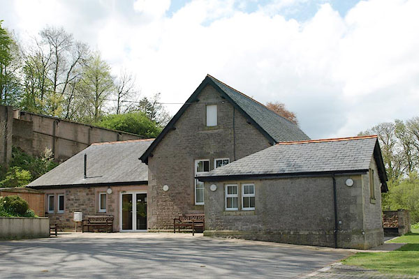 BSS83.jpg (taken 11.5.2010) 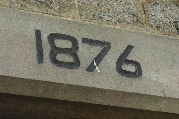 BSS84.jpg Date:- "1876" (taken 11.5.2010) |
||
|
|
||
| evidence:- | old map:- OS County Series (Wmd 23) |
|
| source data:- | Maps, County Series maps of Great Britain, scales 6 and 25
inches to 1 mile, published by the Ordnance Survey, Southampton,
Hampshire, from about 1863 to 1948. "Endowed School" |
|
|
|
||
 Lakes Guides menu.