 Old Cumbria Gazetteer
 |
 |
|
|
| Appleby: Low Wiend | |||
| Low Wiend | |||
| locality:- | Appleby | ||
| civil parish:- | Appleby-in-Westmorland (formerly Westmorland) | ||
| county:- | Cumbria | ||
| locality type:- | street | ||
| coordinates:- | NY682203 | ||
| 1Km square:- | NY6820 | ||
| 10Km square:- | NY62 | ||
|
|
|||
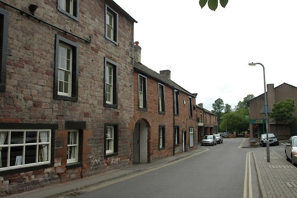 BUS98.jpg (taken 17.6.2011) 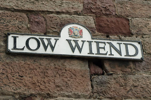 BUS99.jpg Street name sign. (taken 17.6.2011) |
|||
|
|
|||
| evidence:- | old map:- Hill 1754 placename:- School Wiend |
||
| source data:- | Town plan, A Plan of Appleby in Westmorland, scale about 32 ins
to 1 mile, engraved by Nathaniel Hill, 1754.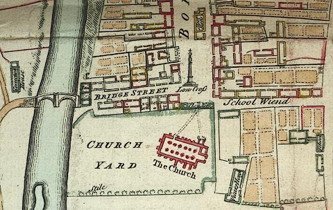 click to enlarge click to enlargeM010P2.jpg "School Wiend" item:- Carlisle Library : Map 211 Image © Carlisle Library |
||
|
|
|||
| mapping:- |  Appleby: Chapel Street Appleby: Chapel Street Appleby: Boroughgate Appleby: Boroughgate Appleby: Chapel Street Appleby: Chapel Street Appleby: Boroughgate Appleby: Boroughgate |
||
|
|
|||
Lakes Guides menu.