 Old Cumbria Gazetteer
 |
 |
|
| boundary stone, Nenthead | ||
| locality:- | Nenthead | |
| civil parish:- | Alston Moor (formerly Cumberland) | |
| county:- | Cumbria | |
| locality type:- | buildings | |
| coordinates:- | NY76734258 | |
| 1Km square:- | NY7642 | |
| 10Km square:- | NY74 | |
| references:- | Listed Buildings 2010 |
|
|
|
||
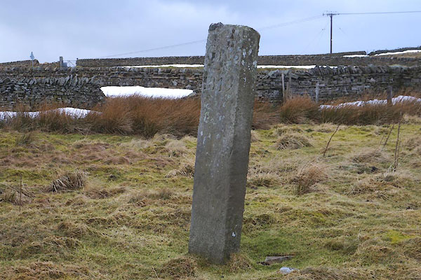 CCM01.jpg (taken 20.2.2015) 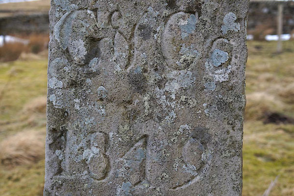 CCM02.jpg "G &Co / 1849" (taken 20.2.2015) |
||
|
|
||
| evidence:- | database:- Listed Buildings 2010 |
|
| source data:- | courtesy of English Heritage "BOUNDARY STONE C2000 YARDS SOUTH EAST OF NENTHEAD IN FIELD ON NORTH SIDE OF ROAD / / / ALSTON MOOR / EDEN / CUMBRIA / II / 73061 / NY7673942586" |
|
| source data:- | courtesy of English Heritage "Boundary marker, probably mid C19. Single stone c4 ft high with carved Roman lettering on 2 faces: East face D.G. Co.; West face Gov & Co., i.e. Governor &Co. (an alternative name for the London Lead Company)." |
|
|
|
||
 Lakes Guides menu.