 Old Cumbria Gazetteer
 |
 |
|
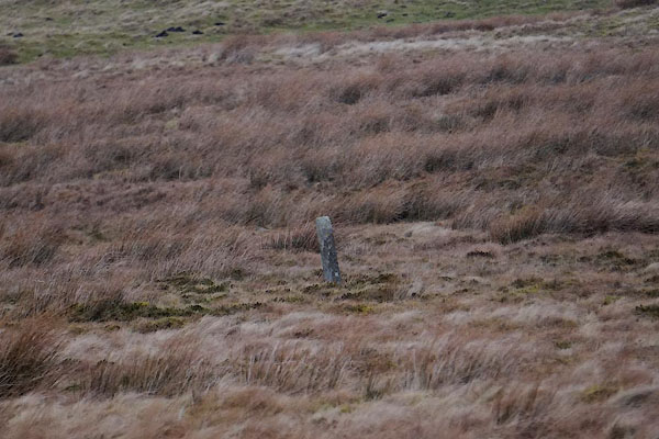
| boundary stone, Nenthead (2) | ||
| civil parish:- | Alston Moor (formerly Cumberland) | |
| county:- | Cumbria | |
| locality type:- | buildings | |
| coordinates:- | NY77074263 | |
| 1Km square:- | NY7742 | |
| 10Km square:- | NY74 | |
| references:- | Listed Buildings 2010 |
|
|
|
||
 CCL99.jpg (taken 20.2.2015) |
||
|
|
||
| evidence:- | database:- Listed Buildings 2010 |
|
| source data:- | courtesy of English Heritage "BOUNDARY STONE C1600 YARDS SOUTH WEST OF NENTHEAD IN FIELD ON DOUTH SIDE OF ROAD / / / ALSTON MOOR / EDEN / CUMBRIA / II / 73062 / NY7707842636" |
|
| source data:- | courtesy of English Heritage "Boundary marker, dated 1849. Single stone, rectangular in section, c5 ft high with carved Roman lettering on dressed south face: G & Co 1849, i.e. Governor &Co. (an alternative name for the London Lead Company)." |
|
|
|
||
 Lakes Guides menu.