 Old Cumbria Gazetteer
 |
 |
|
| boundary stone, Nether Wasdale | ||
| civil parish:- | Nether Wasdale (formerly Cumberland) | |
| civil parish:- | Gosforth (formerly Cumberland) | |
| county:- | Cumbria | |
| locality type:- | boundary stone | |
| locality type:- | parish boundary mark | |
| coordinates:- | NY11670486 | |
| 1Km square:- | NY1104 | |
| 10Km square:- | NY10 | |
| references:- | Listed Buildings 2010 |
|
|
|
||
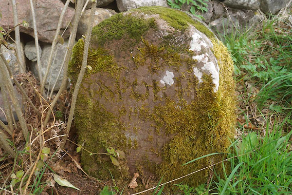 CFZ95.jpg "[ ]OSFOR[T ]" (taken 28.4.2017) 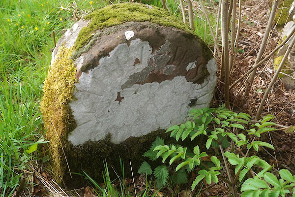 CFZ96.jpg "[NETHER] WASD[A ]" (taken 28.4.2017) |
||
|
|
||
| evidence:- | database:- Listed Buildings 2010 |
|
| source data:- | courtesy of English Heritage "BOUNDARY STONE CIRCA 3 FEET WEST OF CATHOW BRIDGE ON NORTH SIDE OF ROAD / / / WASDALE / COPELAND / CUMBRIA / II / 76277 / NY1167304856" |
|
| source data:- | courtesy of English Heritage "Boundary stone; probably mid/late C19. Monolithic sandstone block c2 ft high with semicircular-head. Inscriptions in Roman lettering on both faces: East face, NETHER WASDALE; West face, GOSFORTH." |
|
|
|
||
 Lakes Guides menu.