 Old Cumbria Gazetteer
 |
 |
|
| boundary stone, Skelton | ||
| locality:- | Morton | |
| civil parish:- | Skelton (formerly Cumberland) | |
| civil parish:- | Hesket (formerly Cumberland) | |
| county:- | Cumbria | |
| locality type:- | boundary stone | |
| locality type:- | parish boundary mark | |
| coordinates:- | NY45103962 | |
| 1Km square:- | NY4539 | |
| 10Km square:- | NY43 | |
|
|
||
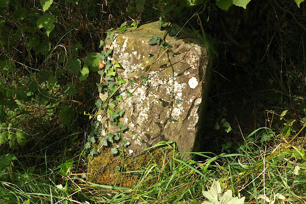 BTQ10.jpg (taken 8.10.2010) |
||
|
|
||
| evidence:- | probably database:- Listed Buildings 2010 |
|
| source data:- | courtesy of English Heritage "BOUNDARY STONE SOUTH EAST OF MORTON / / / SKELTON / EDEN / CUMBRIA / II / 73981 / NY4498139531" |
|
| source data:- | courtesy of English Heritage "Parish boundary stone. Early C19. Red sandstone. Square stone with pyramidal cap, set into ground at roadside, one face inscribed CALTHWAITE; the rear inscription is illegible." |
|
|
|
||
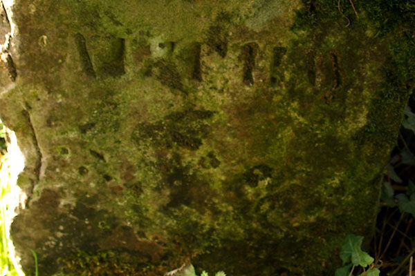 BTQ11.jpg (taken 8.10.2010) |
||
|
|
||
 Lakes Guides menu.