 Old Cumbria Gazetteer
 |
 |
|
| Burton House, Burton-in-Kendal | ||
| Burton House | ||
| Street:- | Main Street | |
| locality:- | Burton-in-Kendal | |
| civil parish:- | Burton-in-Kendal (formerly Westmorland) | |
| county:- | Cumbria | |
| locality type:- | buildings | |
| coordinates:- | SD53037621 | |
| 1Km square:- | SD5376 | |
| 10Km square:- | SD57 | |
| references:- | Listed Buildings 2010 |
|
|
|
||
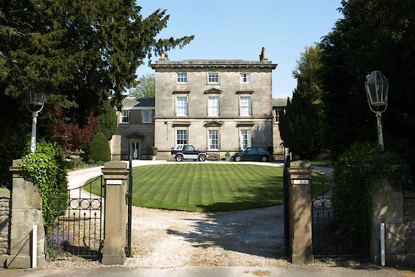 BWJ40.jpg (taken 6.5.2012) |
||
|
|
||
| evidence:- | old map:- OS County Series (Wmd 47 13) placename:- Manor House |
|
| source data:- | Maps, County Series maps of Great Britain, scales 6 and 25
inches to 1 mile, published by the Ordnance Survey, Southampton,
Hampshire, from about 1863 to 1948. house with forml garden "Manor House" |
|
|
|
||
| evidence:- | old map:- Jefferys 1770 (Wmd) |
|
| source data:- | Map, 4 sheets, The County of Westmoreland, scale 1 inch to 1
mile, surveyed 1768, and engraved and published by Thomas
Jefferys, London, 1770.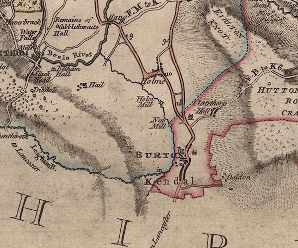 J5SD57NW.jpg house, a drive marked by bushes item:- National Library of Scotland : EME.s.47 Image © National Library of Scotland |
|
|
|
||
| evidence:- | database:- Listed Buildings 2010 placename:- Burton House |
|
| source data:- | courtesy of English Heritage "BURTON HOUSE, NORTH WING; BURTON HOUSE, SOUTH WING; BURTON HOUSE AND REAR GARDEN WALL ATTACHED TO SOUTH WING AND FORMING REAR WALL OF THE WHITE COTTAGE AND OUTLOOK / / MAIN STREET / BURTON IN KENDAL / SOUTH LAKELAND / CUMBRIA / II[star] / 76648 / SD5303276215" |
|
|
|
||
| evidence:- | database:- Listed Buildings 2010 |
|
| source data:- | courtesy of English Heritage "WALLS, GATEPIERS, GATES AND LAMPS AT FRONT ENTRANCE TO BURTON HOUSE / / MAIN STREET / BURTON IN KENDAL / SOUTH LAKELAND / CUMBRIA / II / 76649 / SD5298276219" |
|
|
|
||
 Lakes Guides menu.