 Old Cumbria Gazetteer
 |
 |
|
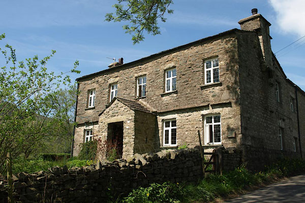
| Craggs Hill, Dent | ||
| Craggs Hill | ||
| Craggs Farm | ||
| civil parish:- | Dent (formerly Yorkshire) | |
| county:- | Cumbria | |
| locality type:- | buildings | |
| coordinates:- | SD67608933 | |
| 1Km square:- | SD6789 | |
| 10Km square:- | SD68 | |
| references:- | Listed Buildings 2010 |
|
|
|
||
 BYK53.jpg (taken 31.5.2013) |
||
|
|
||
| evidence:- | old map:- OS County Series (Yrk 63 8) placename:- Craggs Hill |
|
| source data:- | Maps, County Series maps of Great Britain, scales 6 and 25
inches to 1 mile, published by the Ordnance Survey, Southampton,
Hampshire, from about 1863 to 1948. |
|
|
|
||
| evidence:- | database:- Listed Buildings 2010 placename:- Craggs Hill |
|
| source data:- | courtesy of English Heritage "CRAGGS HILL / / / DENT / SOUTH LAKELAND / CUMBRIA / II / 484272 / SD6760589330" |
|
|
|
||
| evidence:- | database:- Listed Buildings 2010 |
|
| source data:- | courtesy of English Heritage "BARN APPROXIMATELY 5 METRES WEST OF CRAGGS HILL / / / DENT / SOUTH LAKELAND / CUMBRIA / II / 484273 / SD6758589339" |
|
|
|
||
 Lakes Guides menu.