 Old Cumbria Gazetteer
 |
 |
|
|
| Dunnerholme Gate Station, Askam and Ireleth | |||
| gone | |||
| Dunnerholme Gate Station | |||
| site name:- | Furness Railway | ||
| civil parish:- | Askam and Ireleth (formerly Lancashire) | ||
| county:- | Cumbria | ||
| locality type:- | railway station | ||
| locality type:- | level crossing (site) | ||
| coordinates:- | SD21667962 | ||
| 1Km square:- | SD2179 | ||
| 10Km square:- | SD27 | ||
| SummaryText:- | presumably at the level crossing? | ||
|
|
|||
| evidence:- | old map:- OS County Series (Lan 10 16) placename:- Dunnerholme Crossing |
||
| source data:- | Maps, County Series maps of Great Britain, scales 6 and 25
inches to 1 mile, published by the Ordnance Survey, Southampton,
Hampshire, from about 1863 to 1948.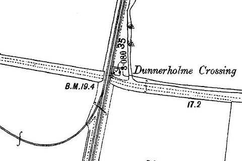 click to enlarge click to enlargeCSRY0126.jpg shows the branch off to limekilns, quarry, etc on Dunnerholme
|
||
|
|
|||
 Lakes Guides menu.