 Old Cumbria Gazetteer
 |
 |
|
| Fairthorn, New Hutton | ||
| Fairthorns | ||
| Street:- | Fairthorn Road | |
| civil parish:- | New Hutton (formerly Westmorland) | |
| county:- | Cumbria | |
| locality type:- | buildings | |
| coordinates:- | SD57169034 | |
| 1Km square:- | SD5790 | |
| 10Km square:- | SD59 | |
| references:- | Listed Buildings 2010 |
|
|
|
||
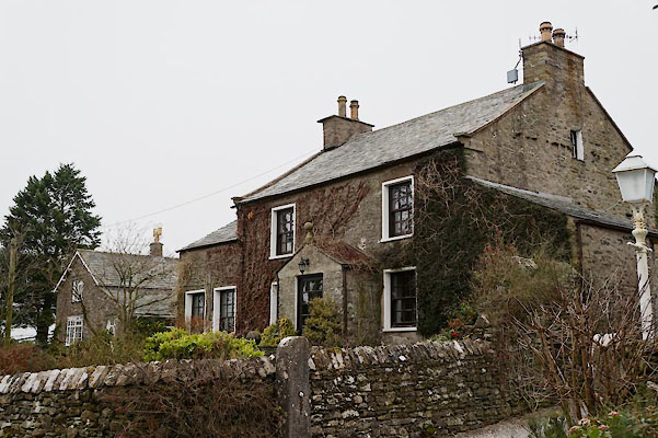 BZU15.jpg (taken 31.1.2014) |
||
|
|
||
| evidence:- | old map:- OS County Series (Wmd 39 10) placename:- Fairthorn |
|
| source data:- | Maps, County Series maps of Great Britain, scales 6 and 25
inches to 1 mile, published by the Ordnance Survey, Southampton,
Hampshire, from about 1863 to 1948. |
|
|
|
||
| evidence:- | database:- Listed Buildings 2010 placename:- Fairthorn |
|
| source data:- | courtesy of English Heritage "FAIRTHORN WITH ADJOINING OUTBUILDINGS / / FAIRTHORN ROAD / NEW HUTTON / SOUTH LAKELAND / CUMBRIA / II / 76695 / SD5716890346" |
|
|
|
||
 Lakes Guides menu.