 Old Cumbria Gazetteer
 |
 |
|
| Flookburgh Farm, Flookburgh | ||
| Flookburgh Farm | ||
| Street:- | Market Street | |
| locality:- | Flookburgh | |
| civil parish:- | Lower Holker (formerly Lancashire) | |
| county:- | Cumbria | |
| locality type:- | buildings | |
| coordinates:- | SD36697574 | |
| 1Km square:- | SD3675 | |
| 10Km square:- | SD37 | |
| references:- | Listed Buildings 2010 |
|
|
|
||
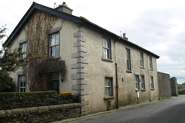 BXJ82.jpg (taken 21.9.2012) |
||
|
|
||
| evidence:- | old map:- OS County Series (Lan 17 10) placename:- Flookburgh Farm |
|
| source data:- | Maps, County Series maps of Great Britain, scales 6 and 25
inches to 1 mile, published by the Ordnance Survey, Southampton,
Hampshire, from about 1863 to 1948. |
|
|
|
||
| evidence:- | database:- Listed Buildings 2010 placename:- Flookburgh Farm |
|
| source data:- | courtesy of English Heritage "FLOOKBURGH FARMHOUSE AND BUILDINGS / / MARKET STREET / LOWER HOLKER / SOUTH LAKELAND / CUMBRIA / II / 77080 / SD3669875743" |
|
|
|
||
 Lakes Guides menu.