 Old Cumbria Gazetteer
 |
 |
|
| Floriston Rigg, Rockcliffe | ||
| Floriston Rigg | ||
| civil parish:- | Rockcliffe (formerly Cumberland) | |
| county:- | Cumbria | |
| locality type:- | buildings | |
| coordinates:- | NY35906421 | |
| 1Km square:- | NY3564 | |
| 10Km square:- | NY36 | |
| references:- | Listed Buildings 2010 |
|
|
|
||
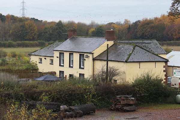 CEH59.jpg (taken 6.11.2015) |
||
|
|
||
| evidence:- | old map:- OS County Series (Cmd 10 14) placename:- Floristownrigg |
|
| source data:- | Maps, County Series maps of Great Britain, scales 6 and 25
inches to 1 mile, published by the Ordnance Survey, Southampton,
Hampshire, from about 1863 to 1948. |
|
|
|
||
| evidence:- | roughly old map:- Ford 1839 map placename:- Floriston |
|
| source data:- | Map, uncoloured engraving, Map of the Lake District of
Cumberland, Westmoreland and Lancashire, scale about 3.5 miles
to 1 inch, published by Charles Thurnam, Carlisle, and by R
Groombridge, 5 Paternoster Row, London, 3rd edn 1843.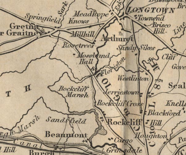 FD02NY36.jpg "Floriston" item:- JandMN : 100.1 Image © see bottom of page |
|
|
|
||
| evidence:- | database:- Listed Buildings 2010 placename:- Floriston Rigg |
|
| source data:- | courtesy of English Heritage "FLORISTON RIGG AND ADJOINING OUTBUILDINGS WITH GINGANG / / / ROCKCLIFFE / CARLISLE / CUMBRIA / II / 77949 / NY3589664208" |
|
|
|
||
 Lakes Guides menu.