 Old Cumbria Gazetteer
 |
 |
|
| Gorrenberry, Scotland | ||
| Gorrenberry | ||
| country:- | Scotland | |
| locality type:- | buildings | |
| coordinates:- | NY46959712 | |
| 1Km square:- | NY4697 | |
| 10Km square:- | NY49 | |
|
|
||
| evidence:- | old map:- Burghley 1590 (facsimile) placename:- Gorramburie |
|
| source data:- | Facsimile map, A Platt of the Opposete Border of Scotland to ye West Marches of England,
parts of Cumberland and Scotland including the Debateable Land, from a manuscript
drawn for William Cecil, Lord Burghley, about 1590, published by R B Armstrong, 1897. courtesy of the National Library of Scotland 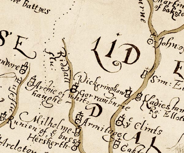 M048NY49.jpg "Gorramburie" circle, tower, cross item:- National Library of Scotland : MS6113 f.267 Image © National Library of Scotland |
|
|
|
||
 Lakes Guides menu.