 Old Cumbria Gazetteer
 |
 |
|
| Grandy Nook, Kendal | ||
| Grandy Nook | ||
| Sandes hall | ||
| Street:- | Low Fellside | |
| civil parish:- | Kendal (formerly Westmorland) | |
| county:- | Cumbria | |
| locality type:- | buildings | |
| coordinates:- | SD51249286 | |
| 1Km square:- | SD5192 | |
| 10Km square:- | SD59 | |
| references:- | Listed Buildings 2010 |
|
|
|
||
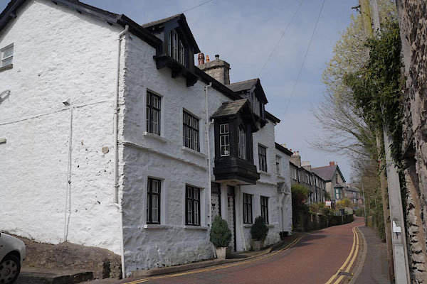 CAE73.jpg (taken 30.3.2014) 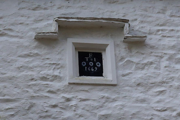 CAE76.jpg Date stone:- "F / T I / 1669" (taken 30.3.2014) |
||
|
|
||
| evidence:- | old map:- OS County Series (Wmd 38 8) placename:- Grandy Nook |
|
| source data:- | Maps, County Series maps of Great Britain, scales 6 and 25
inches to 1 mile, published by the Ordnance Survey, Southampton,
Hampshire, from about 1863 to 1948. |
|
|
|
||
| evidence:- | database:- Listed Buildings 2010 placename:- Grandy Nook item:- date stone (1659); 1650s item:- date stone (1669); 1660s |
|
| source data:- | courtesy of English Heritage "FLATS A,B,C,D,E,F GRANDY NOOK / / LOW FELLSIDE / KENDAL / SOUTH LAKELAND / CUMBRIA / II / 75428 / SD5124892866" |
|
|
|
||
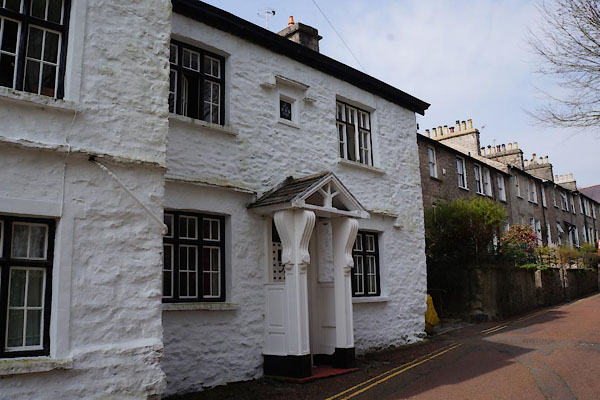 CAE74.jpg Northerly part. (taken 30.3.2014) 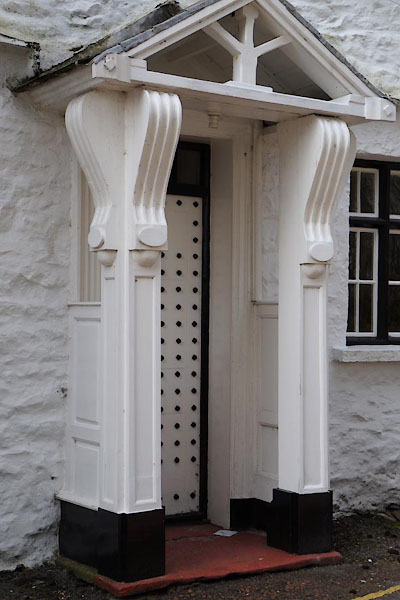 CAE75.jpg Porch. (taken 30.3.2014) |
||
|
|
||
 Lakes Guides menu.