 Old Cumbria Gazetteer
 |
 |
|
| Greenlane End, Lupton | ||
| Greenlane End | ||
| civil parish:- | Lupton (formerly Westmorland) | |
| county:- | Cumbria | |
| locality type:- | buildings | |
| coordinates:- | SD56058052 | |
| 1Km square:- | SD5680 | |
| 10Km square:- | SD58 | |
| references:- | Listed Buildings 2010 |
|
|
|
||
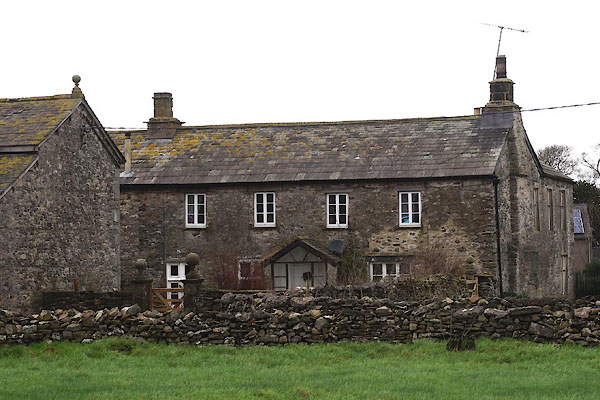 CEM17.jpg (taken 1.1.2016) |
||
|
|
||
| evidence:- | old map:- OS County Series (Wmd 47 2) placename:- Greenland End |
|
| source data:- | Maps, County Series maps of Great Britain, scales 6 and 25
inches to 1 mile, published by the Ordnance Survey, Southampton,
Hampshire, from about 1863 to 1948. |
|
|
|
||
| evidence:- | old map:- Jefferys 1770 (Wmd) placename:- Green Lane End |
|
| source data:- | Map, 4 sheets, The County of Westmoreland, scale 1 inch to 1
mile, surveyed 1768, and engraved and published by Thomas
Jefferys, London, 1770.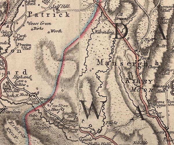 J5SD58SE.jpg "Green Lane End" circle, labelled in italic lowercase text; settlement, farm, house, or hamlet? item:- National Library of Scotland : EME.s.47 Image © National Library of Scotland |
|
|
|
||
| evidence:- | database:- Listed Buildings 2010 placename:- Greenlane End item:- date stone (1834) |
|
| source data:- | courtesy of English Heritage "GREENLANE END & ATTACHED BARN & GARDEN WALL &GATEPOSTS / / / LUPTON / SOUTH LAKELAND / CUMBRIA / II / 75696 / SD5605380524" |
|
|
|
||
| hearsay:- |
In the kitchen is a date stone, moved from somewhere:- |
|
| "[I / B B / 1715]" |
||
| Palmer 1945 |
||
|
|
||
 Lakes Guides menu.