 Old Cumbria Gazetteer
 |
 |
|
| Hall Croft, Sockbridge | ||
| Hall Croft | ||
| locality:- | Sockbridge | |
| civil parish:- | Sockbridge and Tirril (formerly Westmorland) | |
| county:- | Cumbria | |
| locality type:- | buildings | |
| coordinates:- | NY50212692 | |
| 1Km square:- | NY5026 | |
| 10Km square:- | NY52 | |
| references:- | Listed Buildings 2010 |
|
|
|
||
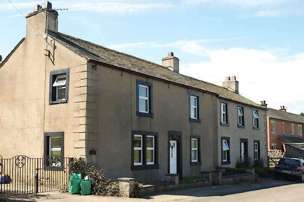 BXB08.jpg (taken 10.8.2012) |
||
|
|
||
| evidence:- | perhaps old map:- OS County Series (Wmd 3 15) placename:- Croftfoot |
|
| source data:- | Maps, County Series maps of Great Britain, scales 6 and 25
inches to 1 mile, published by the Ordnance Survey, Southampton,
Hampshire, from about 1863 to 1948. |
|
|
|
||
| evidence:- | database:- Listed Buildings 2010 placename:- Hall Croft |
|
| source data:- | courtesy of English Heritage "HALL CROFT / / / SOCKBRIDGE AND TIRRIL / EDEN / CUMBRIA / II / 74592 / NY5021426920" |
|
|
|
||
| evidence:- | database:- Listed Buildings 2010 |
|
| source data:- | courtesy of English Heritage "OUTBUILDINGS APPROXIMATELY 30 METRES TO SOUTH EAST OF HALL CROFT / / / SOCKBRIDGE AND TIRRIL / EDEN / CUMBRIA / II / 74594 / NY5024626918" |
|
|
|
||
| evidence:- | database:- Listed Buildings 2010 item:- date stone (1813) |
|
| source data:- | courtesy of English Heritage "BARN IMMEDIATELY TO EAST OF HALL CROFT / / / SOCKBRIDGE AND TIRRIL / EDEN / CUMBRIA / II / 74593 / NY5023426933" |
|
|
|
||
 Lakes Guides menu.