 Old Cumbria Gazetteer
 |
 |
|
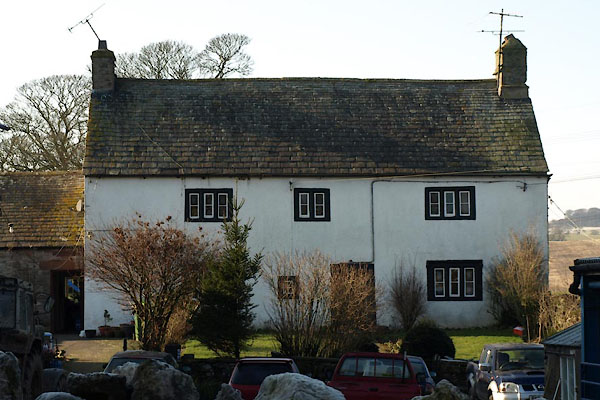
| High Hall, Little Strickland | ||
| High Hall | ||
| civil parish:- | Little Strickland (formerly Westmorland) | |
| county:- | Cumbria | |
| locality type:- | buildings | |
| coordinates:- | NY56421946 | |
| 1Km square:- | NY5619 | |
| 10Km square:- | NY51 | |
| references:- | Listed Buildings 2010 |
|
|
|
||
 BVW31.jpg (taken 3.2.2012) |
||
|
|
||
| evidence:- | old map:- OS County Series (Wmd 14 2) placename:- High Hall placename:- Hall, High |
|
| source data:- | Maps, County Series maps of Great Britain, scales 6 and 25
inches to 1 mile, published by the Ordnance Survey, Southampton,
Hampshire, from about 1863 to 1948. |
|
|
|
||
| evidence:- | database:- Listed Buildings 2010 placename:- High Hall item:- date stone (1600) |
|
| source data:- | courtesy of English Heritage "HIGH HALL / / / LITTLE STRICKLAND / EDEN / CUMBRIA / II / 74331 / NY5642219464" |
|
|
|
||
| evidence:- | database:- Listed Buildings 2010 |
|
| source data:- | courtesy of English Heritage "OUTBUILDING TO SOUTH EAST OF HIGH HALL / / / LITTLE STRICKLAND / EDEN / CUMBRIA / II / 74332 / NY5642819470" |
|
|
|
||
 Lakes Guides menu.