 Old Cumbria Gazetteer
 |
 |
|
| Hollage Bridge, Torver | ||
| Hollage Bridge | ||
| site name:- | Torver Beck | |
| locality:- | Torver | |
| civil parish:- | Torver (formerly Lancashire) | |
| county:- | Cumbria | |
| locality type:- | bridge | |
| coordinates:- | SD28529407 | |
| 1Km square:- | SD2894 | |
| 10Km square:- | SD29 | |
|
|
||
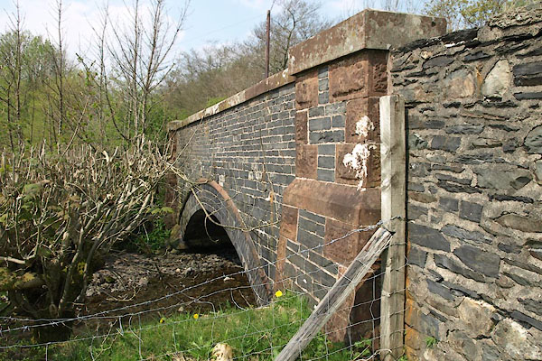 BUI80.jpg (taken 19.4.2011) 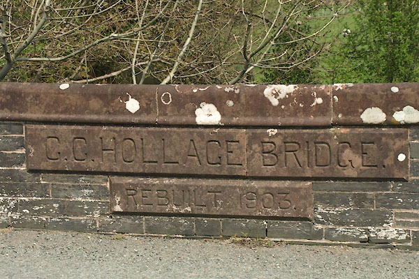 BUI81.jpg Inscription:- "C.C. HOLLAGE BRIDGE / REBUILT 1903." (taken 19.4.2011) |
||
|
|
||
| evidence:- | old map:- OS County Series (Lan 4 11) placename:- Hollace Bridge |
|
| source data:- | Maps, County Series maps of Great Britain, scales 6 and 25
inches to 1 mile, published by the Ordnance Survey, Southampton,
Hampshire, from about 1863 to 1948. "Hollace Bridge" |
|
|
|
||
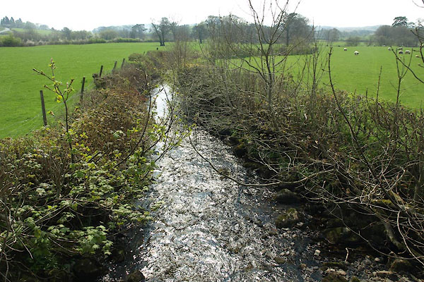 BUI82.jpg View of river. (taken 19.4.2011) |
||
|
|
||
 Lakes Guides menu.