 Old Cumbria Gazetteer
 |
 |
|
| Junction Cottages, Burneside | ||
| Junction Cottages | ||
| locality:- | Burneside | |
| civil parish:- | Strickland Ketel (formerly Westmorland) | |
| county:- | Cumbria | |
| locality type:- | buildings | |
| coordinates:- | SD50719542 | |
| 1Km square:- | SD5095 | |
| 10Km square:- | SD59 | |
|
|
||
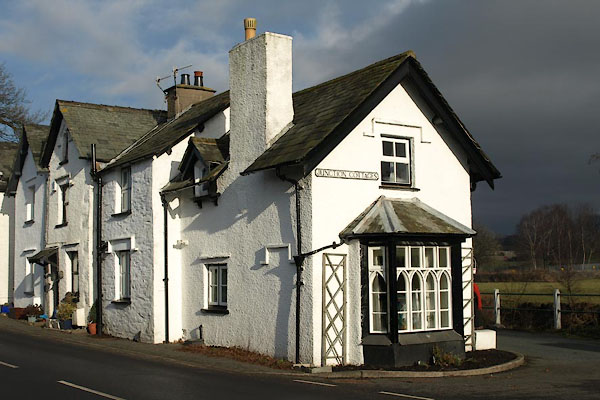 BTX78.jpg (taken 22.1.2011) 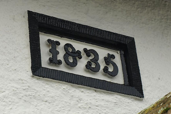 BTX79.jpg "1835" (taken 22.1.2011) |
||
|
|
||
| evidence:- | old map:- OS County Series (Wmd 33 16) placename:- Junction Cottage |
|
| source data:- | Maps, County Series maps of Great Britain, scales 6 and 25
inches to 1 mile, published by the Ordnance Survey, Southampton,
Hampshire, from about 1863 to 1948. |
|
|
|
||
| evidence:- | old map:- OS County Series (Wmd 33 16) placename:- Junction Cottage |
|
| source data:- | Maps, County Series maps of Great Britain, scales 6 and 25
inches to 1 mile, published by the Ordnance Survey, Southampton,
Hampshire, from about 1863 to 1948. "Junction Cottage" (not labelled as a toll house; no line across road) |
|
|
|
||
| evidence:- | database:- Listed Buildings 2010 placename:- Junction Cottages item:- date stone (1835) |
|
| source data:- | courtesy of English Heritage "JUNCTION COTTAGES / 1 AND 2 / BURNESIDE ROAD / STRICKLAND KETEL / SOUTH LAKELAND / CUMBRIA / II / 76421 / SD5070595419" |
|
|
|
||
 Lakes Guides menu.