 Old Cumbria Gazetteer
 |
 |
|
| Kershopefoot Bridge, Kershopefoot | ||
| Kershopefoot Bridge | ||
| site name:- | Liddel Water | |
| locality:- | Kershopefoot | |
| civil parish:- | Nicholforest (formerly Cumberland) | |
| county:- | Cumbria | |
| locality type:- | bridge | |
| locality type:- | boundary feature | |
| locality type:- | county boundary feature | |
| locality type:- | national boundary feature | |
| coordinates:- | NY47468292 | |
| 1Km square:- | NY4782 | |
| 10Km square:- | NY48 | |
| country:- | Scotland | |
|
|
||
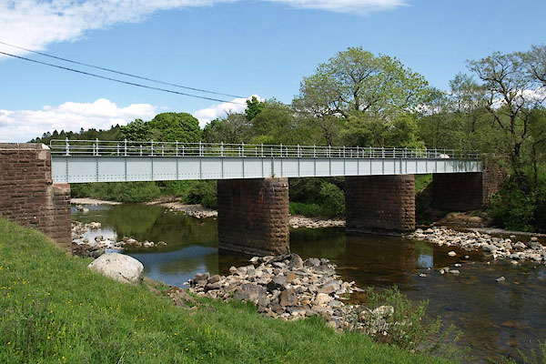 BSV97.jpg (taken 4.6.2010) 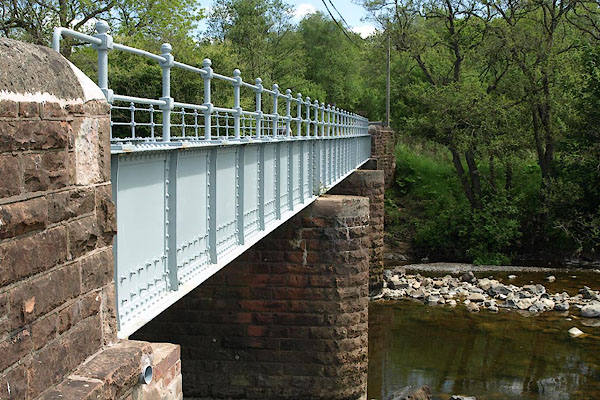 BSV98.jpg (taken 4.6.2010) |
||
|
|
||
| evidence:- | old map:- OS County Series (Cmd 3 2) |
|
| source data:- | Maps, County Series maps of Great Britain, scales 6 and 25
inches to 1 mile, published by the Ordnance Survey, Southampton,
Hampshire, from about 1863 to 1948. "Ford" |
|
|
|
||
| evidence:- | old map:- Bowen and Kitchin 1760 |
|
| source data:- | Map, hand coloured engraving, A New Map of the Counties of
Cumberland and Westmoreland Divided into their Respective Wards,
scale about 4 miles to 1 inch, by Emanuel Bowen and Thomas
Kitchin et al, published by T Bowles, Robert Sayer, and John
Bowles, London, 1760.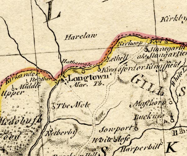 BO18NY47.jpg road crosses stream, on national boundary Cumberland Scotland item:- Armitt Library : 2008.14.10 Image © see bottom of page |
|
|
|
||
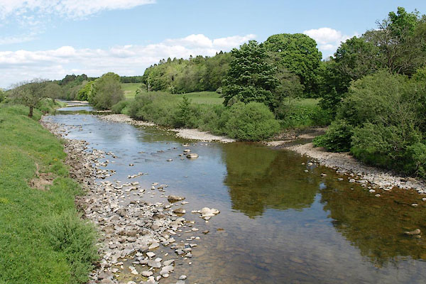 BSV99.jpg View of river. (taken 4.6.2010) |
||
|
|
||
 Lakes Guides menu.