 Old Cumbria Gazetteer
 |
 |
|
| Kirkhouse Farm, Kirkhouse | ||
| Kirkhouse Farm | ||
| locality:- | Kirkhouse | |
| civil parish:- | Farlam (formerly Cumberland) | |
| county:- | Cumbria | |
| locality type:- | buildings | |
| coordinates:- | NY56715984 | |
| 1Km square:- | NY5659 | |
| 10Km square:- | NY55 | |
| references:- | Listed Buildings 2010 |
|
|
|
||
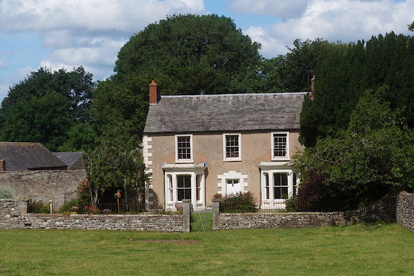 CBH03.jpg (taken 28.7.2014) 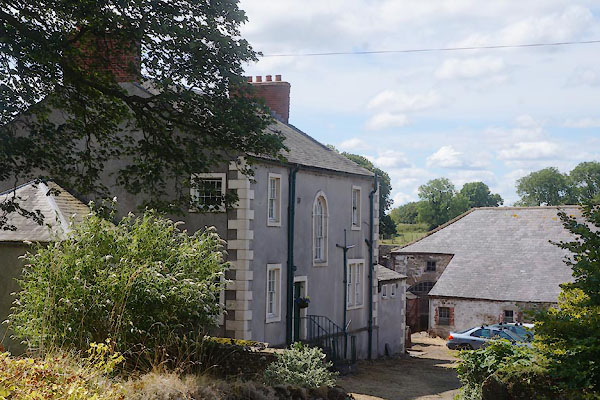 CBH04.jpg (taken 28.7.2014) |
||
|
|
||
| evidence:- | probably old map:- Donald 1774 (Cmd) placename:- Kirk House |
|
| source data:- | Map, hand coloured engraving, 3x2 sheets, The County of Cumberland, scale about 1
inch to 1 mile, by Thomas Donald, engraved and published by Joseph Hodskinson, 29
Arundel Street, Strand, London, 1774.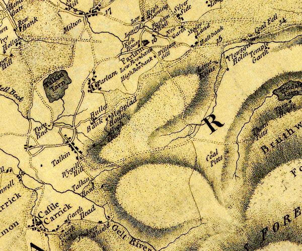 D4NY55NE.jpg "Kirk House" block or blocks, labelled in lowercase; a hamlet or just a house item:- Carlisle Library : Map 2 Image © Carlisle Library |
|
|
|
||
| evidence:- | database:- Listed Buildings 2010 placename:- Kirkhouse Farm |
|
| source data:- | courtesy of English Heritage "KIRKHOUSE FARMHOUSE / / / FARLAM / CARLISLE / CUMBRIA / II / 78024 / NY5671059843" |
|
|
|
||
 Lakes Guides menu.