 Old Cumbria Gazetteer
 |
 |
|
| Langster Pike, Northumberland | ||
| suggested | ||
| Langster Pike | ||
| county:- | Northumberland | |
| locality type:- | hill | |
| 1Km square:- | NY6281 (guess) | |
| 10Km square:- | NY68 | |
| SummaryText:- | Unidentified place | |
| references:- | Bowen and Kitchin 1760 |
|
|
|
||
| evidence:- | old map:- Bowen and Kitchin 1760 placename:- Langster Pike |
|
| source data:- | Map, hand coloured engraving, A New Map of the Counties of
Cumberland and Westmoreland Divided into their Respective Wards,
scale about 4 miles to 1 inch, by Emanuel Bowen and Thomas
Kitchin et al, published by T Bowles, Robert Sayer, and John
Bowles, London, 1760.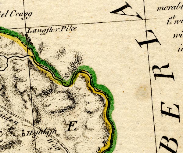 BO18NY77.jpg "Langster Pike" hillock item:- Armitt Library : 2008.14.10 Image © see bottom of page |
|
|
|
||
 Lakes Guides menu.