 Old Cumbria Gazetteer
 |
 |
|
| Low Beckside Farm, Sedbergh | ||
| Low Beckside Farm | ||
| Street:- | Cautley Road | |
| civil parish:- | Sedbergh (formerly Yorkshire) | |
| county:- | Cumbria | |
| locality type:- | buildings | |
| coordinates:- | SD69289556 | |
| 1Km square:- | SD6995 | |
| 10Km square:- | SD69 | |
| references:- | Listed Buildings 2010 |
|
|
|
||
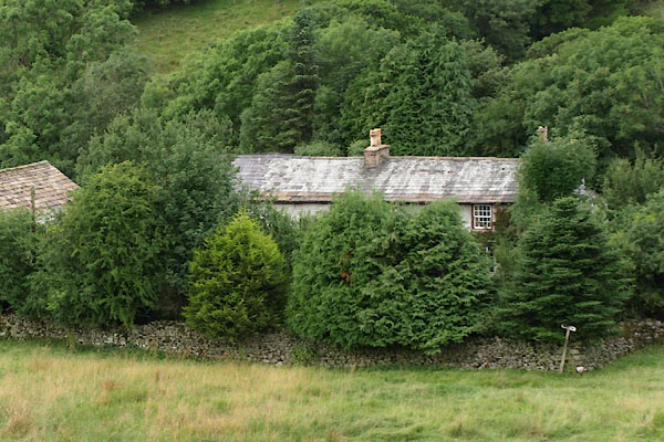 BYZ33.jpg (taken 6.8.2013) |
||
|
|
||
| evidence:- | old map:- OS County Series (Yrk 49 5) placename:- Beck Side |
|
| source data:- | Maps, County Series maps of Great Britain, scales 6 and 25
inches to 1 mile, published by the Ordnance Survey, Southampton,
Hampshire, from about 1863 to 1948. |
|
|
|
||
| evidence:- | database:- Listed Buildings 2010 placename:- Low Beckside Farm |
|
| source data:- | courtesy of English Heritage "LOW BECKSIDE FARMHOUSE AND ATTACHED PEAT HOUSE AND BARN / / CAUTLEY ROAD / SEDBERGH / SOUTH LAKELAND / CUMBRIA / II / 484534 / SD6928495569" |
|
|
|
||
 Lakes Guides menu.