 Old Cumbria Gazetteer
 |
 |
|
| Low Colwith, Lakes | ||
| Low Colwith | ||
| locality:- | Colwith | |
| civil parish:- | Lakes (formerly Westmorland) | |
| county:- | Cumbria | |
| locality type:- | buildings | |
| coordinates:- | NY33040314 | |
| 1Km square:- | NY3303 | |
| 10Km square:- | NY30 | |
| references:- | Listed Buildings 2010 |
|
|
|
||
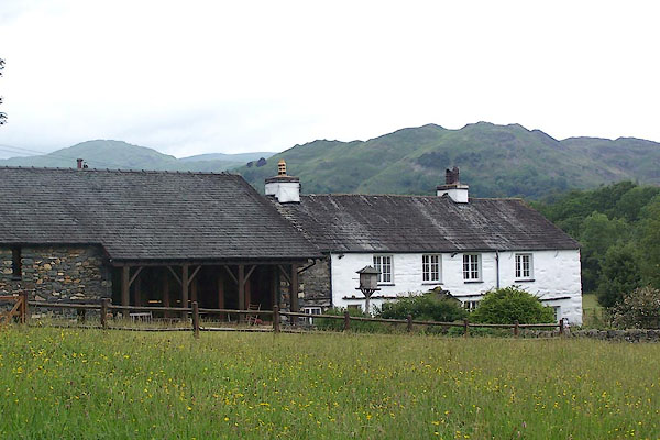 BMG93.jpg (taken 23.6.2006) |
||
|
|
||
| evidence:- | old map:- OS County Series (Wmd 25 12) placename:- Low Colwith placename:- Colwith, Low |
|
| source data:- | Maps, County Series maps of Great Britain, scales 6 and 25
inches to 1 mile, published by the Ordnance Survey, Southampton,
Hampshire, from about 1863 to 1948. |
|
|
|
||
| evidence:- | database:- Listed Buildings 2010 placename:- Low Colwith |
|
| source data:- | courtesy of English Heritage "LOW COLWITH WITH ATTACHED FARM BUILDINGS / / / LAKES / SOUTH LAKELAND / CUMBRIA / II / 452292 / NY3304903141" |
|
|
|
||
 Lakes Guides menu.