 Old Cumbria Gazetteer
 |
 |
|
| Millbeck Place, Millbeck | ||
| Millbeck Place | ||
| locality:- | Millbeck | |
| civil parish:- | Underskiddaw (formerly Cumberland) | |
| county:- | Cumbria | |
| locality type:- | buildings | |
| coordinates:- | NY25702612 | |
| 1Km square:- | NY2526 | |
| 10Km square:- | NY22 | |
| references:- | Listed Buildings 2010 |
|
|
|
||
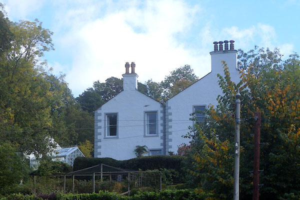 CEB39.jpg (taken 13.10.2015) |
||
|
|
||
| evidence:- | probably old map:- OS County Series (Cmd 56 14) placename:- Skiddaw Bank |
|
| source data:- | Maps, County Series maps of Great Britain, scales 6 and 25
inches to 1 mile, published by the Ordnance Survey, Southampton,
Hampshire, from about 1863 to 1948. |
|
|
|
||
| evidence:- | database:- Listed Buildings 2010 placename:- Millbeck Place |
|
| source data:- | courtesy of English Heritage "MILLBECK PLACE / / / UNDERSKIDDAW / ALLERDALE / CUMBRIA / II / 72205 / NY2570726122" |
|
|
|
||
 Lakes Guides menu.