 Old Cumbria Gazetteer
 |
 |
|
| Moorhead Cottages, Barrow-in-Furness | ||
| Moorhead Cottages | ||
| Street:- | Rampside Road | |
| civil parish:- | Barrow-in-Furness (formerly Lancashire) | |
| county:- | Cumbria | |
| locality type:- | buildings | |
| coordinates:- | SD23236835 | |
| 1Km square:- | SD2368 | |
| 10Km square:- | SD26 | |
| references:- | Listed Buildings 2010 |
|
|
|
||
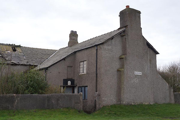 CAG34.jpg (taken 4.4.2014) 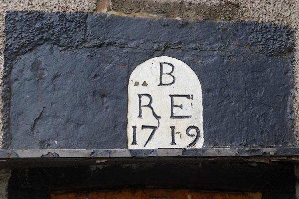 CAG35.jpg Date stone:- "B / R E / 1719" (taken 4.4.2014) |
||
|
|
||
| evidence:- | old map:- OS County Series (Lan 22 9) placename:- Moor Head |
|
| source data:- | Maps, County Series maps of Great Britain, scales 6 and 25
inches to 1 mile, published by the Ordnance Survey, Southampton,
Hampshire, from about 1863 to 1948. |
|
|
|
||
| evidence:- | database:- Listed Buildings 2010 item:- date stone (1719) |
|
| source data:- | courtesy of English Heritage "NUMBER 1 MOORHEAD COTTAGES AND ATTACHED BARN / / RAMPSIDE ROAD / BARROW IN FURNESS / BARROW IN FURNESS / CUMBRIA / II / 388566 / SD2323668353" |
|
|
|
||
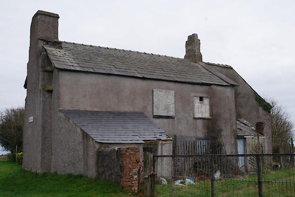 CAG36.jpg (taken 4.4.2014) |
||
|
|
||
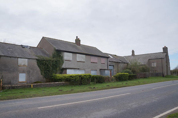 CAG37.jpg The whole row. (taken 4.4.2014) |
||
| If this was the 5 bays of barn there have been some alterations. |
||
|
|
||
 Lakes Guides menu.