 Old Cumbria Gazetteer
 |
 |
|
| Old Rectory, Boltongate | ||
| Boltongate Rectory | ||
| locality:- | Boltongate | |
| civil parish:- | Boltons (formerly Cumberland) | |
| county:- | Cumbria | |
| locality type:- | buildings | |
| coordinates:- | NY22964063 | |
| 1Km square:- | NY2240 | |
| 10Km square:- | NY24 | |
| references:- | Listed Buildings 2010 |
|
|
|
||
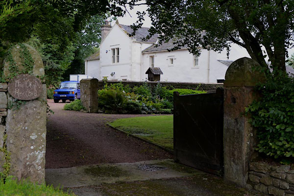 CGI50.jpg (taken 4.8.2017) |
||
|
|
||
| evidence:- | old map:- OS County Series (Cmd 36 12) placename:- Rectory |
|
| source data:- | Maps, County Series maps of Great Britain, scales 6 and 25
inches to 1 mile, published by the Ordnance Survey, Southampton,
Hampshire, from about 1863 to 1948. |
|
|
|
||
| evidence:- | database:- Listed Buildings 2010 placename:- Rectory, The |
|
| source data:- | courtesy of English Heritage "THE RECTORY / / / BOLTONS / ALLERDALE / CUMBRIA / II / 72333 / NY2296340636" |
|
|
|
||
| notes:- |
Pele tower and attached hall. |
|
| Perriam, D R &Robinson, J: 1998: Medieval Fortified Buildings of Cumbria: CWAAS::
ISBN 1 873124 23 6; plan and illustration |
||
|
|
||
 Lakes Guides menu.